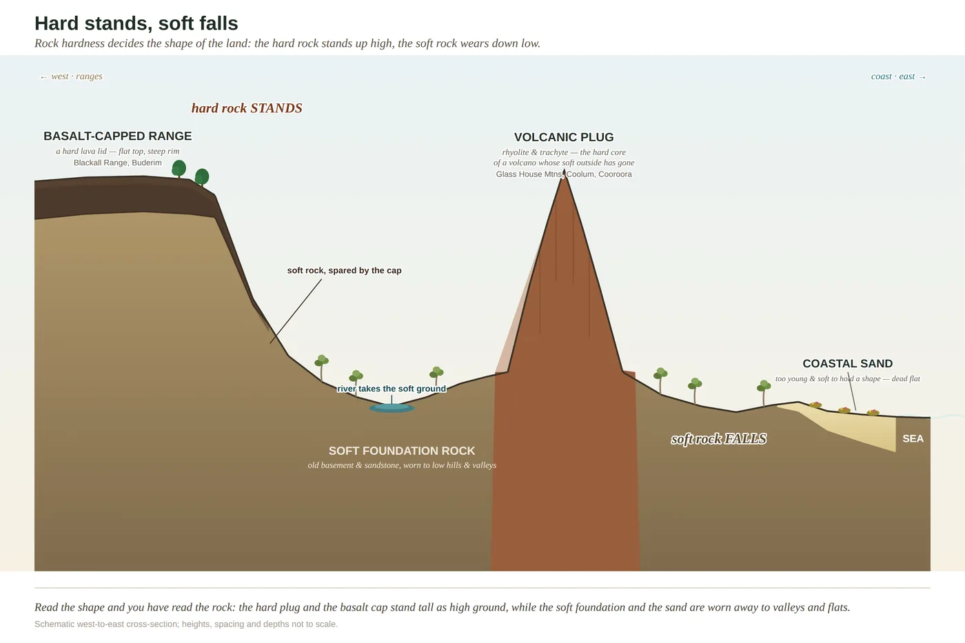
Landforms in section
The shape of the coast in profile — range, foothills, floodplain, sand and sea. The bones the whole gradient rides on.
A$12AUDGet the file
Prints & charts
Every chart in Same Sky, Different Ground was drawn by hand for this coast — built from real elevation and geology, not clip art. Now the best twelve are print-ready files you can hang: in a classroom, an office, a field station, a shed wall, a hallway between the door and the boots.
They aren't decoration pretending to be science. Each one teaches something true about how this coast is put together — why rainforest sits on the range and wildflowers on bleached sand, how a dune holds a lake, where fire draws its line. Buy the file, print it at whatever size suits your wall, and read it every time you walk past.
If you buy a single chart, make it this one. It is the spine of the whole book.
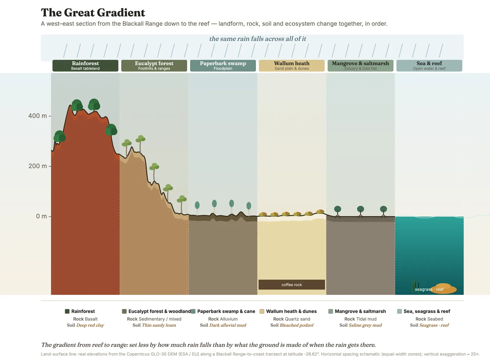
The whole coast in a single section — rainforest, gum forest, swamp, wallum, estuary and reef stacked down one slope, drawn from real elevation data. This is the picture the entire book hangs from: learn to read this and you can read the country.
How the coast is built and shaped — the profile of the land, the making of its soils, and the layered forest at the wet end of the slope.
The shape of the coast in profile — range, foothills, floodplain, sand and sea. The bones the whole gradient rides on.
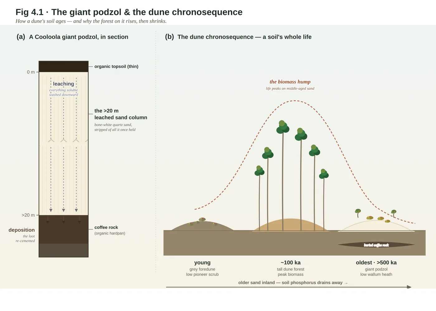
How wallum sand builds itself into a podzol over thousands of years — the slow chemistry that bleaches the ground bone-white.
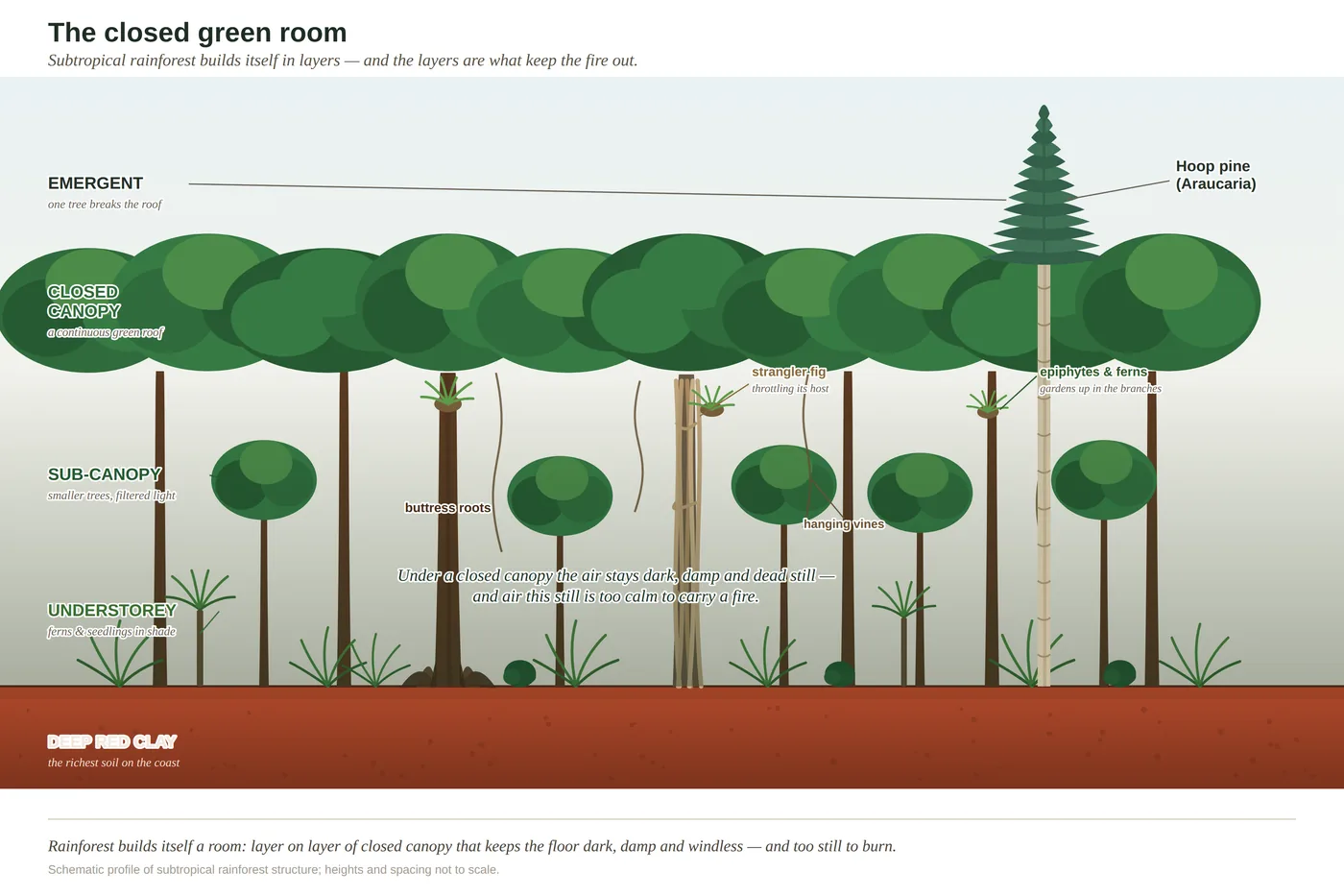
The layered architecture of a rainforest — canopy, sub-canopy, understorey and floor, and how the light gives out on the way down.
The wet edges of the country — where the tide sorts the estuary, where a swamp keeps its zones, how a dune holds a lake, and how the land runs on underwater.
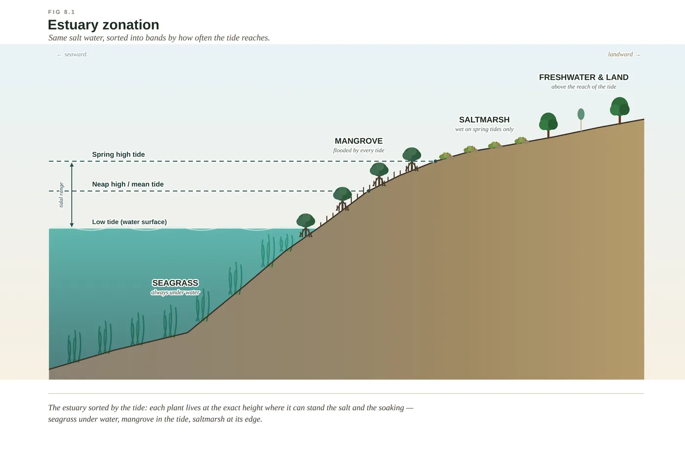
Who stands where across an estuary — seagrass, mangrove and saltmarsh, each sorted by exactly how far the tide reaches.
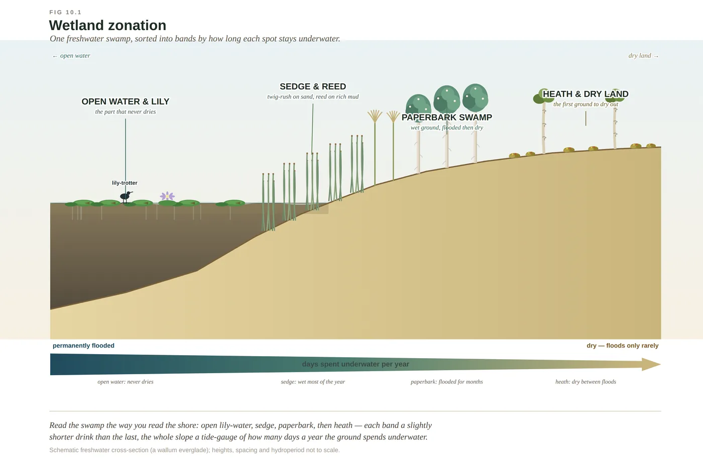
The zones of a paperbark swamp and coastal wetland, laid out from open water to the dry edge.
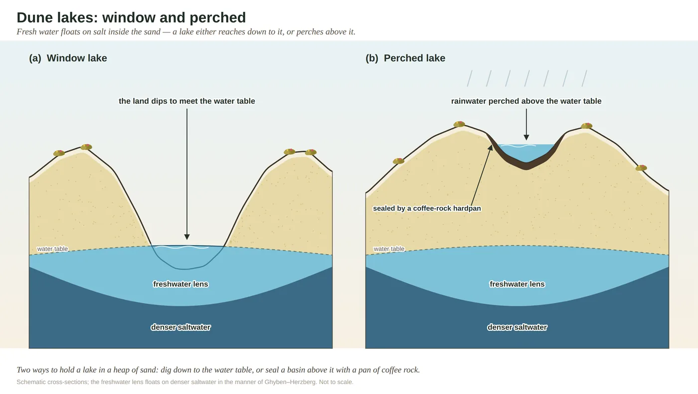
How the coast's dune lakes hold water — perched lakes sitting on their own sealed floors, window lakes cut down into the watertable.
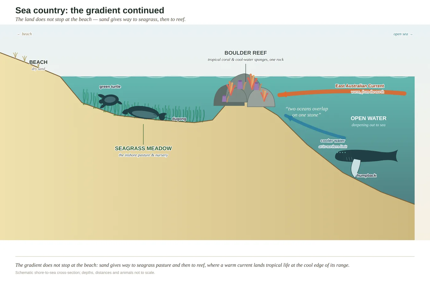
The near-shore in section — beach to boulder reef to open water, with the seagrass meadows in between. The land doesn't stop at the sand.
The forces that keep drawing and re-drawing the coast — the fire that fixes a boundary, the volcanoes that built the peaks, and the turning of the naturalist's year.
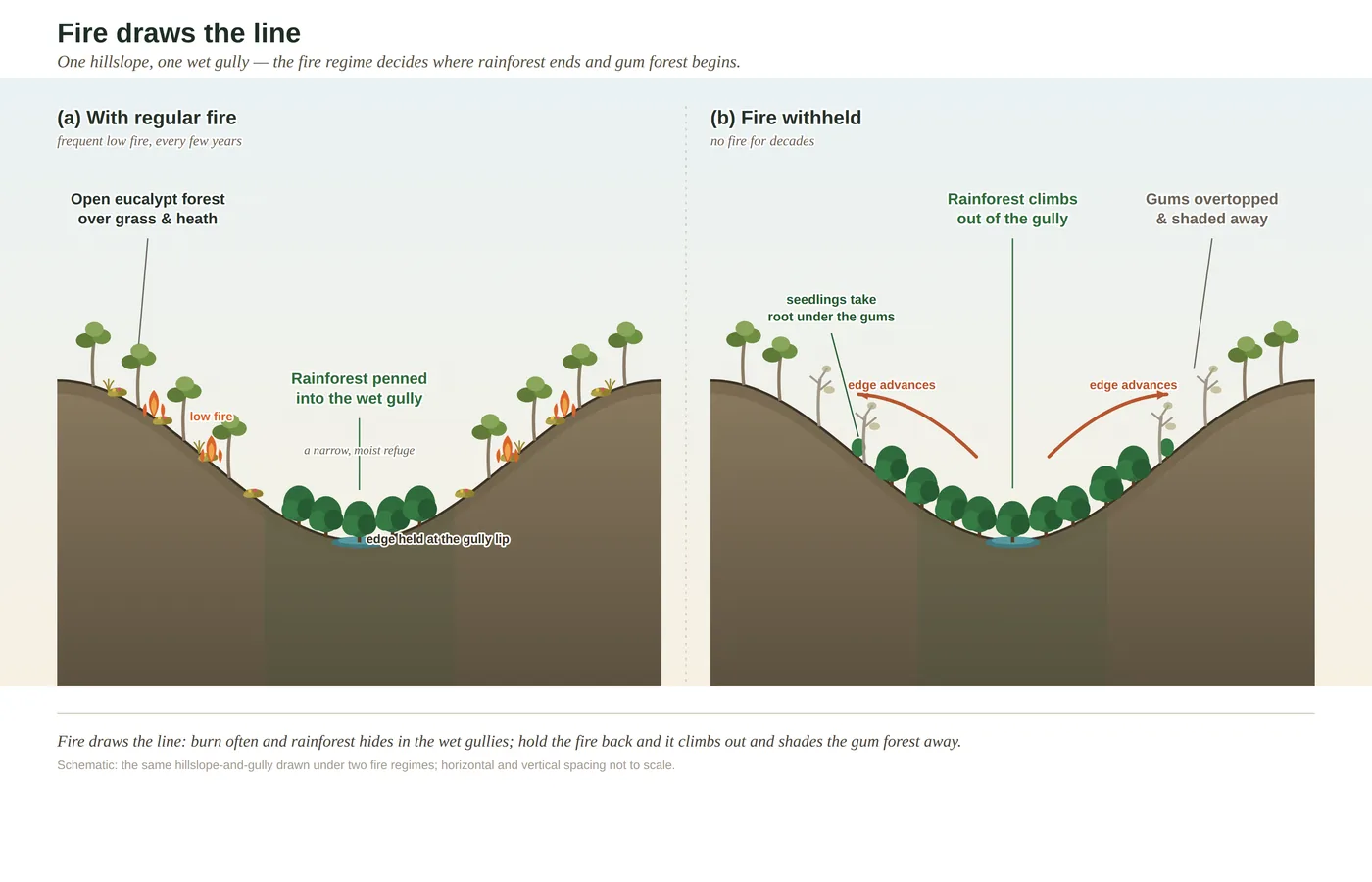
How fire holds the hard line between eucalypt forest and rainforest — one of the sharpest, most telling boundaries on the coast.
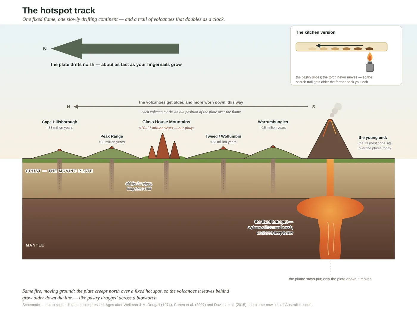
The hotspot that built the Glass House Mountains and the hinterland peaks — a line of old volcanoes left behind as the continent drifted north over it.
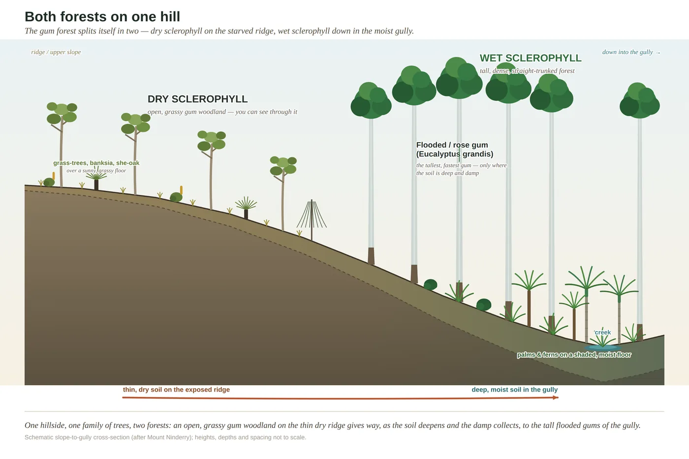
A geological cross-section through Mount Ninderry — the inner bones of a single hinterland peak, cut open.
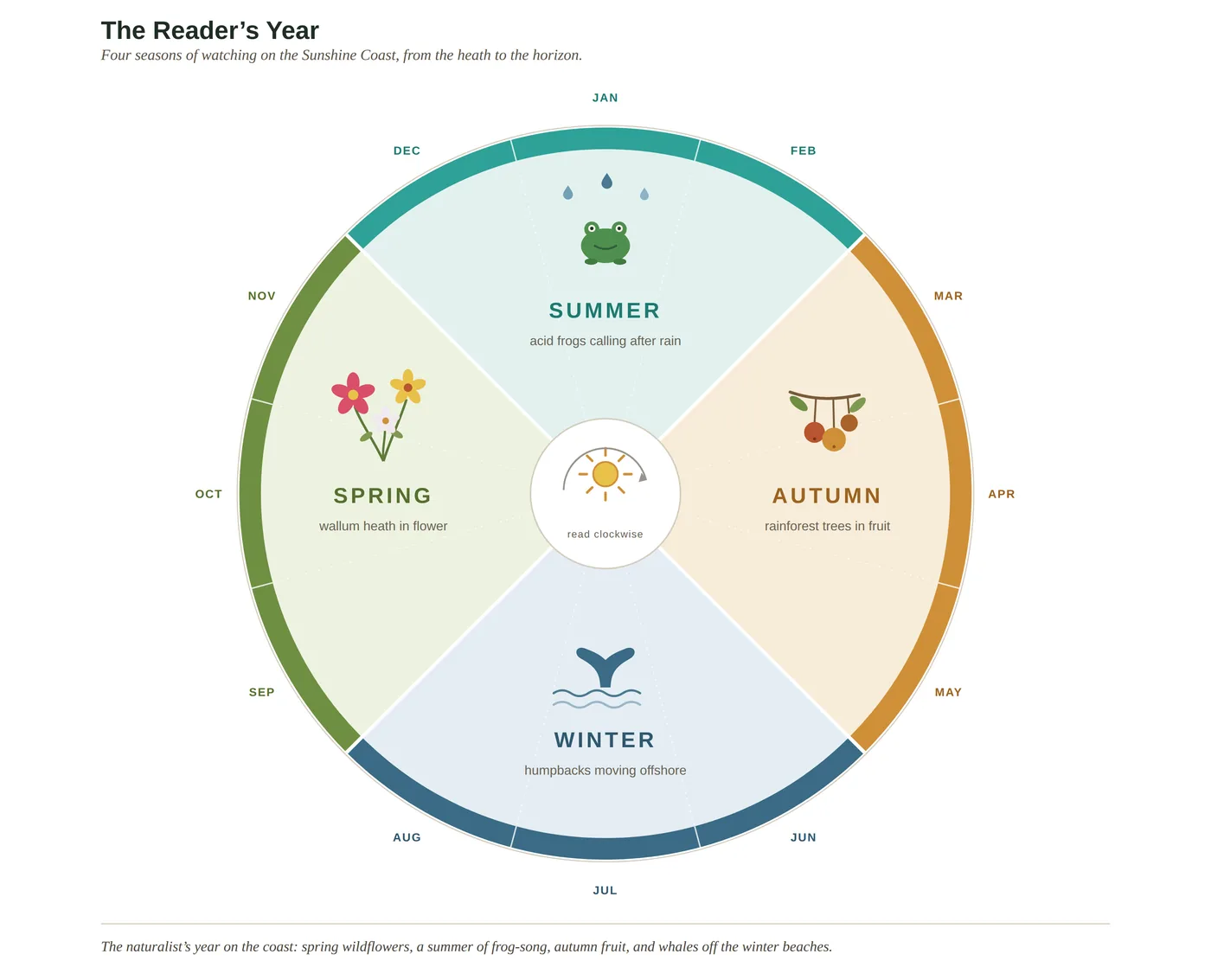
The four seasons of the coast drawn as a wheel — what flowers, arrives and spawns, and when. A naturalist's calendar for the wall.
Pricing & formats
Every chart is a high-resolution file you print yourself — at home, at the office, or through any print shop. No physical stock, no shipping, no waiting: the file is yours the moment you buy it.
Single chart
A$12 AUD
Any one of the twelve. High-resolution PDF + PNG, sized for A3 at 300 DPI.
Choose a chart aboveAny three · best value
A$29 AUD
Pick any three charts as a bundle and save. Ideal for a themed wall — the gradient, the water, the deep-time set.
Get the any-three bundleThe complete set of 12
A$79 AUD
All twelve charts in one download — the whole coast, from the making of the rock to the naturalist's year. The full teaching set.
Get the complete setA print-ready PDF and a high-resolution PNG for each chart. No app, no account beyond the store, no expiry.
Sized for A3 at a true 300 DPI. Prints crisp at A4 through A3; fine down to a desk card or up to a modest poster.
Print at home, or send the file to any print or copy shop. Matte or satin paper suits these best.
Print-on-demand posters, shipped to your door, are coming soon. Join the list to hear when.
Every sheet carries a small footer with the book title, this site and the ISBN — so a chart on a wall is also a quiet pointer back to the book it came from. Charts are © Daniel Addington and sold for personal and classroom use; they are not licensed for resale or redistribution.