Same Sky, Different Ground

Explore the map

The whole coast, in relief

This is the real shape of the land, built from elevation data — the ranges, the sand masses, the rivers and the passage, all sitting exactly where the weather left them. Click a landmark to read what it is and why it's there.
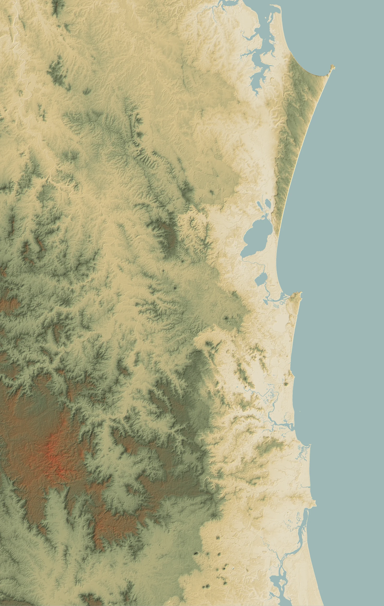
Shaded-relief map of the Sunshine Coast, from the Glass House Mountains and Pumicestone Passage in the south to Cooloola and Double Island Point in the north — the same canonical relief used in the book and the app

Read the land itself

The blue peaks, the high green ranges, the pale sand country, the tea-dark rivers — tap any marker to see what shaped it. On a phone, scroll the map and tap.

The maps

The same country, three ways

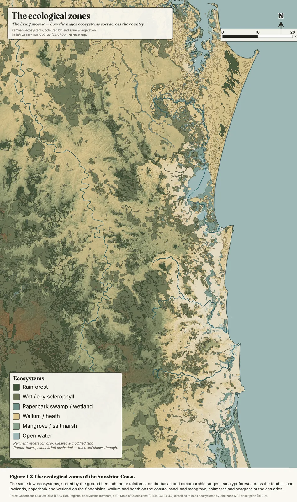
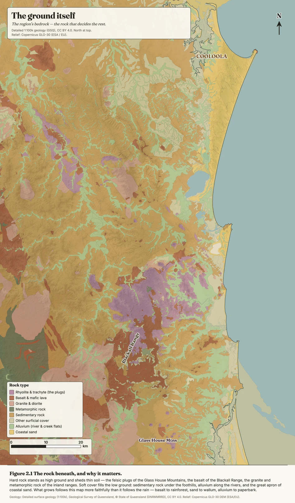
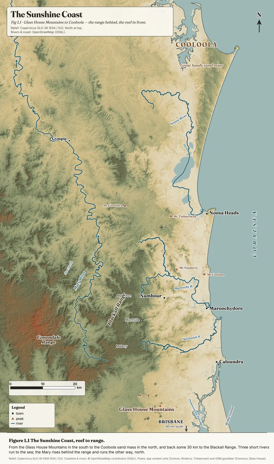
One relief, one palette, one set of names. The locality above the rock beneath the living cover — each map drawn on the same shaded base so they read against one another. On a phone, tap any map to open it full-size and pinch in.

Fig 1.1 · LocalityWhere it all sits — reef to range, the ranges behind, the rivers between. The base map for everything that follows.
Ecological zonesThe living cover, sorted — rainforest, sclerophyll forest, wallum, wetland and mangrove, over the same relief.
Fig 2.1 · GeologyThe bones underneath, coloured by land zone — basalt, metamorphic range, igneous plug and sand. Why the country grows what it grows.

Relief from the Copernicus GLO-30 DEM (© DLR/ESA, CC BY 4.0). Regional-ecosystem and land-zone mapping: State of Queensland (Department of Environment, Science and Innovation), CC BY 4.0. Every map here shares one base, palette and type with the book and the app.

Want to read it on the ground?

The map is the shape of the land. The field guide is how to read it once you're standing in it — the five-minute method, where to go, what's safe. Free, and made for a pocket.

Open the field guide About the book